


Fictional Places on Earth
Gravett IslandSainte ClairePortage CreekFair HavenCarbon CreekLa Barre
Star Trek shows locations on Earth on various occasions. Most of them are located in the USA, some in Europe, and very few elsewhere on our planet. Most of these places really exist, although episodes are almost never shot on the actual location and they look accordingly different than in reality. For instance, while we can locate the various buildings of Starfleet in and around San Francisco, the matte paintings or CG creations often don't get the topology right. Likewise, sets such as the New York Streets don't look like the real New York, San Francisco, New Orleans or Detroit at the second glance.
A few locations on Earth that we could see in Star Trek were completely made up. We learn a bit about these places in the dialogues and in the form of maps or direction signs and we are able to narrow down where they should be located if they really existed. The following article takes care of:
- Gravett Island, Pacific Ocean ("Star Trek: First Contact")
- Sainte Claire, northern France (VOY: "The Killing Game I+II")
- Portage Creek, Indiana, USA (VOY: "11:59")
- Fair Haven, Country Clare, Ireland (VOY: "Fair Haven", "Spirit Folk")
- Carbon Creek, Pennsylvania, USA (ENT: Carbon Creek")
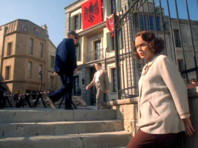
- La Barre, France (TNG: "Family", "All Good Things", PIC: "Remembrance", "Maps and Legends", "The End is the Beginning" and season 2)
Gravett Island
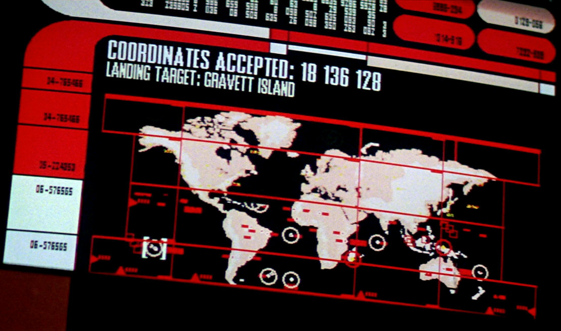
After Picard has made up his mind in "Star Trek: First Contact", he activates the ship's auto-destruct sequence in order to destroy the Borg. As Picard, Crusher and Worf confirm the auto-destruct one by one, a map of Earth with several highlighted spots appears on a screen. We can see how the display zooms in to the "Landing Target" of the escape pods on Gravett Island, somewhere in the Pacific Ocean. Picard then says "See you on Gravett Island", confirming that this is the place the crew of the Enterprise is being evacuated to. Gravett Island doesn't exist in reality. It was named for Jacques Gravett, assistant to Ron D. Moore.
We can never see Gravett Island except for its location and outline on the screen on the bridge. The coastline of the island on screen tells us it is a rocky island, rather than an atoll. The coordinates are given as "18 136 128" on the display and don't make sense as geographic coordinates.
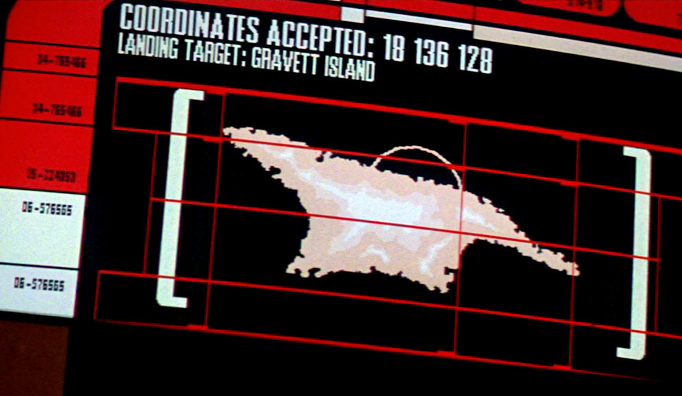
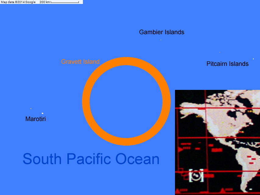
However, we can see on the Earth map that Gravett Island is about the same longitude as Anchorage and the same latitude as Cape Town. This puts the fictional island in a very remote part of the South Pacific, fittingly not far from the famous Pitcairn Islands (of the Bounty mutineers) that would be several hundred kilometers to the northeast. The closest real island groups would be the Gambier Islands some 300-400km to the north and Marotiri (Bass Islands) at about the same distance to the west, both parts of French Polynesia, the latter of which is uninhabited.
Sainte Claire
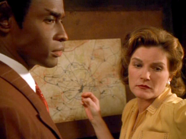
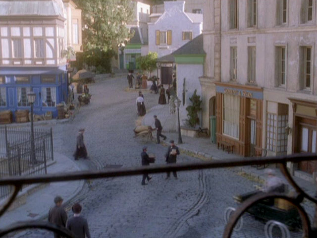
The Hirogen chose Sainte Claire, a fictional town in France, for their holodeck scenario in VOY: "The Killing Game I+II", in which the crew of Voyager take the roles of the French Resistance, fighting Nazis and Hirogen during the advance of the allied forces in 1944. The holodeck scenario about Sainte Claire may originally have been an educational program and was intentionally set in a generic French town that doesn't really exist, in order to allow some artistic license in the depiction of the place and of the events.
In real life, Sainte Claire was filmed in the Little Europe set.
Sainte Claire looks quite small, which is also verbally confirmed in the episode. Chakotay, who in his role as an allied captain had been in the town before the war, says: "Sainte Claire's not a big place." Yet, "Le Coeur de Lion" is a bar of a kind that would not exist in a village or a very small town. Sainte Claire has a certain degree of urbanity.
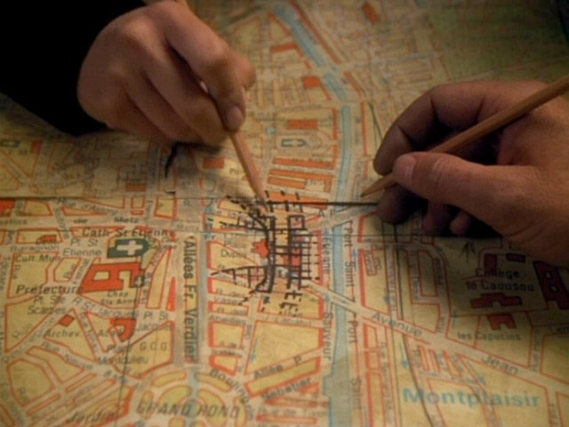
Furthermore, the town appears to be of major strategic importance, as Katrine aka Janeway says: "The Americans won't even be able to approach this city without our help, and if they can't liberate Sainte Claire the assault into Germany could fail." Janeway also mentions that she expects the "American 4th Infantry to invade Sainte Claire Tuesday dawn." This may be historically correct, as the 4th Infantry Division landed at Utah Beach in June 1944 and then advanced through northern France and Belgium into Germany. It is obvious that Sainte Claire has to be located somewhere in northern France, not far from the Belgian border. However, the maps of the surroundings of Sainte Claire don't give us more information about its possible location or about a possible real place standing in for the fictional town on a map. The second map that we can see up close in the first part doesn't even include any form of labels.
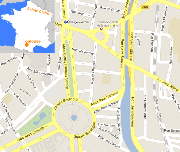
In the second part of the episode we can see a street map of Sainte Claire. This map can be identified as one of Toulouse. As the Art Department was probably just looking for a "French-style" street map to stand in for Sainte Claire, it doesn't matter that Toulouse is actually located in southern France. However, Toulouse is a major city, and the map with its systematic street grid and various roundabouts and squares makes Sainte Claire look a lot bigger here than it is otherwise supposed to be.
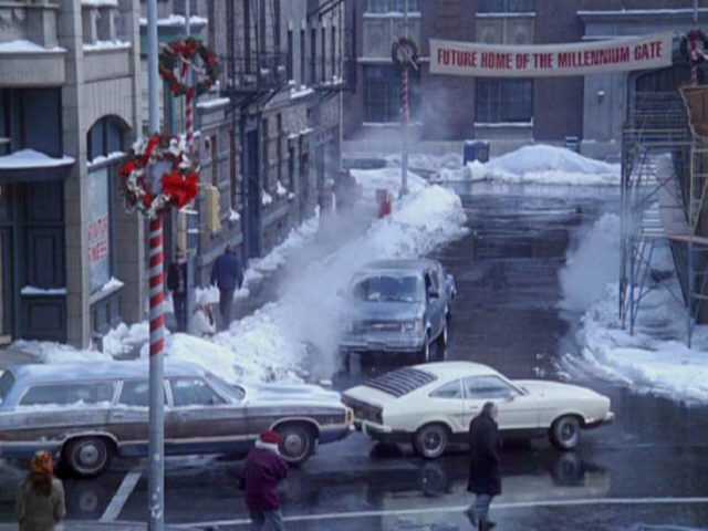
Portage Creek
The town Portage Creek in Indiana is the site of the Millennium Gate, the first self-contained ecosystem to be constructed on Earth, as seen in VOY: "11:59". Construction of the Millennium Gate started soon after December 31, 2000 when Henry Janeway was the last inhabitant to give up his resistance against the project. The building was dedicated in 2012. In the course of the construction the whole town was likely demolished. There is a town named Portage on Lake Michigan in Indiana, but none named Portage Creek. Most likely a non-existing town was chosen on purpose, because it would cease to exist in the Star Trek Universe. Since the Millennium Gate doesn't exist in reality either, the non-existence of Portage Creek is not really a continuity issue. Portage Creek, however, is a real place in Alaska.
The episode was filmed in Paramount's New York Streets set.
The most definite evidence for the location of Portage Creek is that Henry Janeway goes to Bloomington to purchase supplies because the local businesses are boycotting him because of his resistance against the Millennium Gate. Bloomington is a city some 80 kilometers south of Indianapolis. Henry Janeway certainly wouldn't travel across the whole state to buy items that are available (to anyone but him) in Portage Creek itself or in the vicinity. So Portage Creek is almost definitely not more than 50 kilometers away from Bloomington. 50 kilometers would be far enough and 80,000 inhabitants would be big enough for Janeway to make sure the people there don't resent his resistance against the project. Also, Portage Creek likely isn't located north of Bloomington because then Indianapolis may be an even better place to get what he needs.
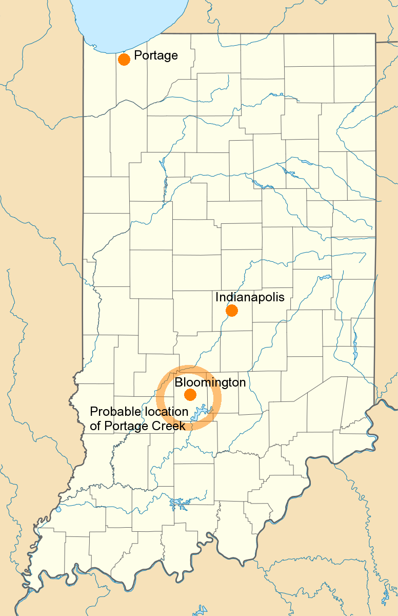
On a perhaps related note, Bloomington, Indiana is the hometown of Kathryn Janeway, as mentioned in the later Voyager episode "Imperfection". It certainly has no bearing on the issue that Janeway may have been born close to where her ancestors came from, but her pride in the Millennium Gate in "11:59" (provided that it was a success) sounds a lot like local patriotism.
Shannon O'Donnell is on her way to Florida when she passes Portage Creek, but since we don't know where she came from it doesn't give us a cue about the location of Portage Creek. The fact that Canton, Ohio, is being considered as an alternative building site is not helpful either. Furthermore, Henry Janeway says he's never been outside Indiana. Well, this would be a stretch if the town we are talking about were Portage, located rather close to the border of Illinois and to Chicago. But he likely exaggerates a bit.
Shannon O'Donnell gives us more possible cues with this mention of regional attractions not far from Portage Creek (but not necessarily in Indiana): "I saw the world's largest ball of string this morning, and the world's largest beefsteak tomato this afternoon. It was the size of a Volkswagen. The string, not the tomato." While I always thought of the "largest ball of strings" as more of a joke, there are indeed several contenders. None of them seems to be close enough to Indiana. And the reference regarding the tomato is just too indefinite.
Fair Haven
The Irish town of Fair Haven can be seen in two Voyager episodes, "Fair Haven" and "Spirit Folk". In both episodes Fair Haven is said to be located in County Clare in Ireland. Fair Haven is small but it has a train station, which may further narrow down the town's location, considering that the railway network in the western part of Ireland is rather sparse. The sign on the train station also gives us the Gaelic name of Fair Haven: "Cuan Soineanta" (of which, unsurprisingly, the English translation is "Fair Haven"). Just as in the case of Sainte Claire, the Fair Haven holoprogram may have been laid out intentionally not to depict a real but rather a generic Irish town.
Just like previously Sainte Claire, Fair Haven was filmed in the accordingly redressed Little Europe set.
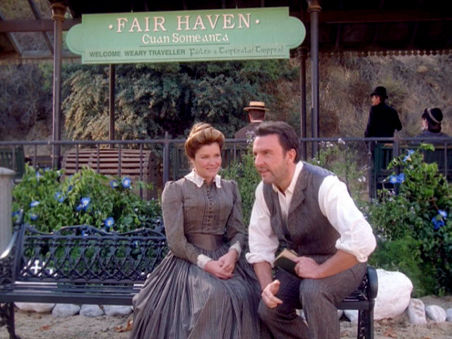
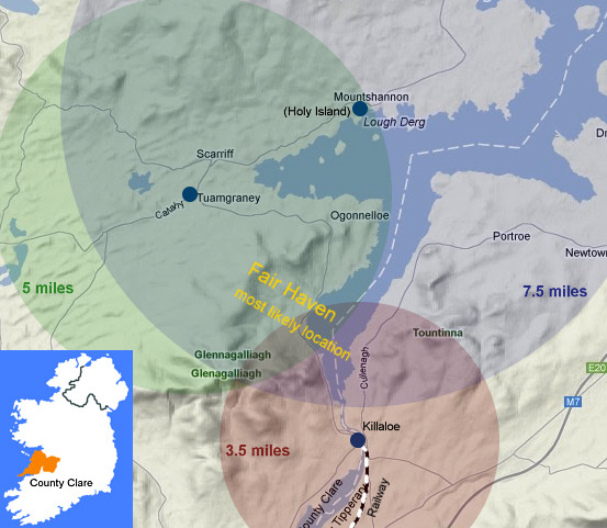
The by far best clue for the location of Fair Haven is a direction sign in the town center. It includes (counter-clockwise, in 90° steps) the directions to:
- Killalow, 3.5 miles
- Holy Island, 7.5 miles
- Tuamgraney, 5 miles
- an unknown fourth place
All three recognizable places are located around the Lough Derg, a major lake in County Clare, and all are within a radius of a couple of miles. As we draw a circle with the radius given on the sign around every town on the sign, we can see that Fair Haven must be on the southwestern shore of Lough Derg, roughly halfway between Killalow and Tuamgraney. Only the direction to Holy Island wouldn't really work, because it would send us right into the lake instead of roughly the same direction as Tuamgraney. Of course, there is no real town in the place where Fair Haven must be located. And the nearest railway is a line that ends in Killalow and always did.

Some other places in County Clare are mentioned in the episode. In VOY: "Fair Heaven", Seamus doesn't fully remember if he met his wife on the way to the fair in Doolin or to Kilkee for trout fishing. Doolin is 80km away from the supposed location of Fair Haven, and Kilkee is 90km away. That's quite a journey for a time in which many places could not be reached by railway, but at most with horse carts. Anyway, both places would be equally plausible. Also, Katie O'Clare aka Kathryn Janeway wants to take Michael Sullivan to a Nickelodeon in Doolin, as mentioned in VOY: "Spirit Folk".
Carbon Creek
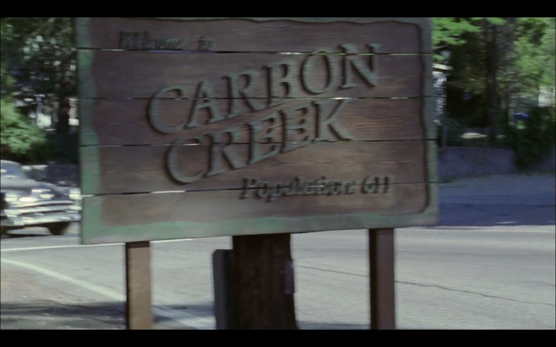
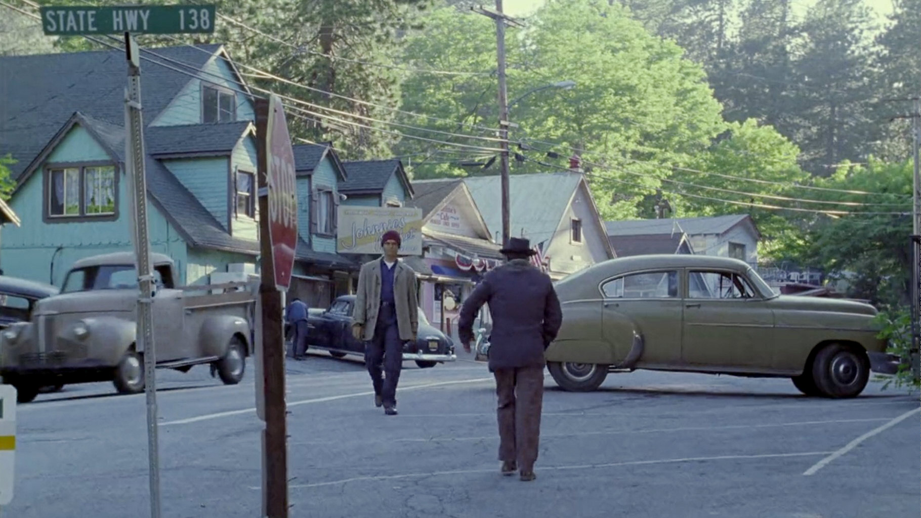
Carbon Creek is a small mining town in Pennsylvania, with a population of 611 according to the town sign. A Vulcan survey ship crashed near Carbon Creek in 1957, while observing the launch of Sputnik. Among the three survivors was T'Pol's great-grandmother T'Mir. This is why T'Pol visits Carbon Creek in 2152. Her visit confirms that Carbon Creek exists as a real town in the Star Trek Universe, unlike the two above holographic creations. However, there is no real Carbon Creek in Pennsylvania.
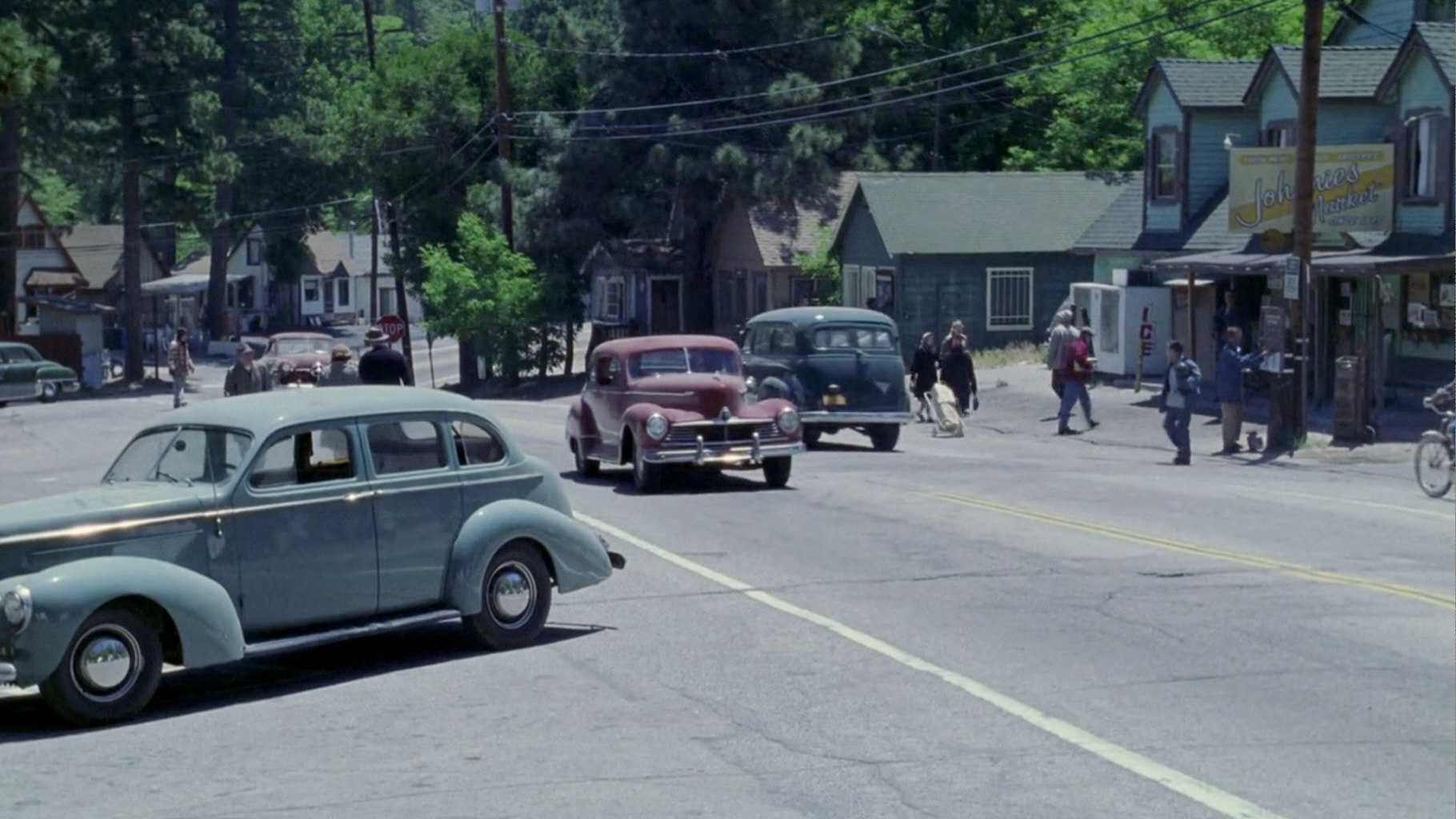
The Carbon Creek scenes were filmed on the California State Route 138 in Crestline, north of Los Angeles, with its distinctive look of the 1950s that didn't require a lot of redressing. We can see a road sign "State Hwy 138" in one shot in the episode, which is obviously an original sign of the California State Highway 138.

If we are looking for the possible real location of Carbon Creek in Pennsylvania, there is conflicting evidence:
Theory 1: Carbon Creek is in western Pennsylvania.
The highway sign is the best visual evidence in the episode. Pennsylvania also has a State Highway 138, which can be found in Butler County in the western part of the state. On the other hand, green signs like this one likely didn't exist in the 1950s. There are some old mines in this county according to the Pennsylvania Mine Map Atlas, although it is doubtful they were in operation in the 1950s. At the end of the episode T'Mir goes to a patent office in Pittsburgh, which is not far away from the possible location of Carbon Creek in the western half of the state. Mestral and Maggie go to a baseball match in Doylestown, which in this case could be a town of that name in Ohio, some 120km west of Butler County, PA and some two hours by car today.
Theory 2: Carbon Creek is in eastern Pennsylvania.
It is possible that Carbon Creek was originally meant to be located in the Coal Region of eastern Pennsylvania (perhaps even in Carbon County), where mining still dominated the economy in the 1950s. Doylestown, the site of the baseball match, was likely meant to be the more prominent town of that name and the seat of Bucks County in the southeastern corner of the Pennsylvania (not far from Philadelphia), rather than Doylestown, OH. There is no mention as to whether the home team of Carbon Creek or perhaps a neighboring bigger town was on an away game in Doylestown or whether Maggie had another connection to Doylestown. However, if Carbon Creek were in the western region of the state, it seems very unlikely that they would go to a match so far away. The trip would take five and a half hours by car still today (one-way). Rather than that, someone might travel from the Coal Region to Doylestown, PA to support his home team, which would take less than two hours by car.
Overall, theory 2 seems a bit more plausible. The highway signs comes into sight only accidentally anyway. And someone may have recommended the patent lawyer in Pittsburgh to T'Mir, rather than one in nearby Philadelphia.
Well, there are other factual errors in the episode. Velcro was registered by George de Mestral(!) in 1955, two years prior to the episode. Also, Sputnik was launched on October 4, 1957 and stayed in orbit until January 4, 1958. No exact dates are given in the episode, but when the Vulcan ship crashed it should have been fall or winter in Pennsylvania. In the episode the lush vegetation of Carbon Creek looks like spring or summer throughout the episode. Also, the baseball season should have been long over when Maggie invited Mestral, unless the three Vulcans had been in town for already the complete fall and winter at that time.
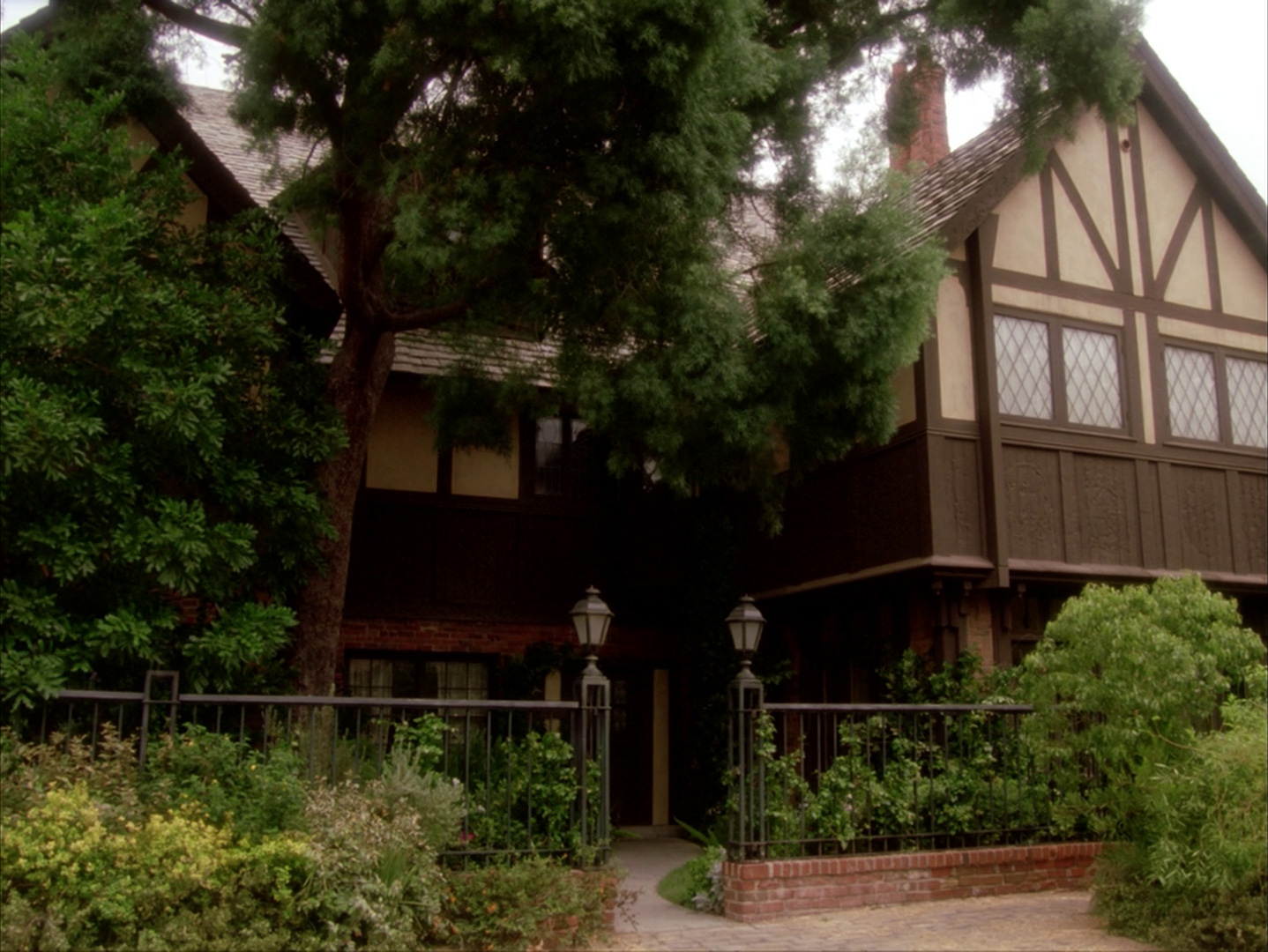
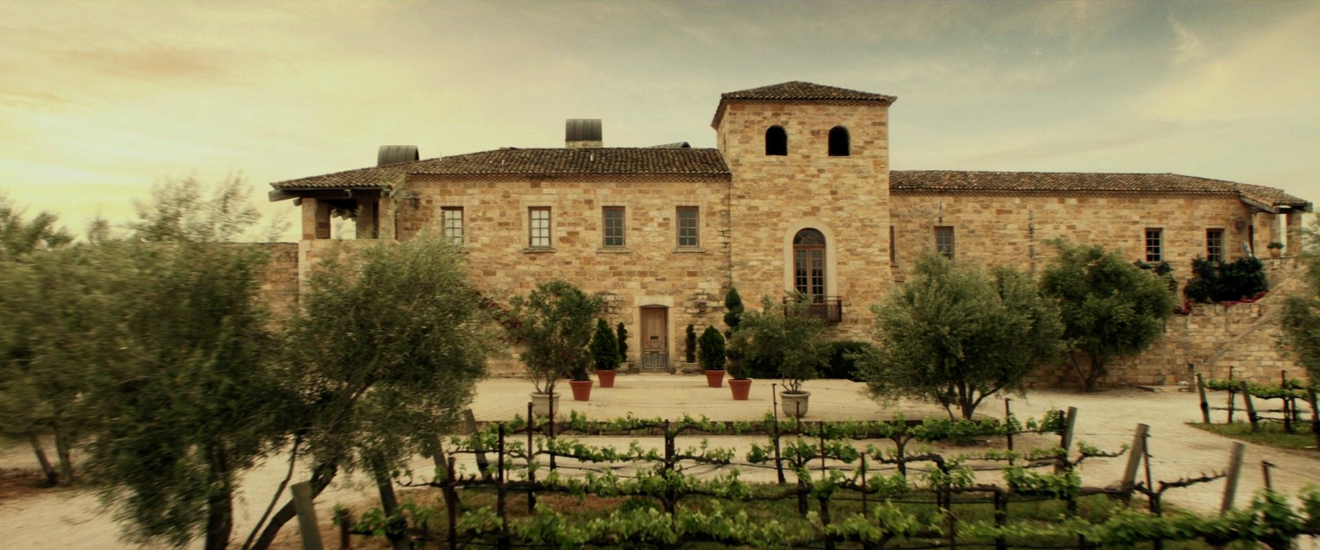
La Barre
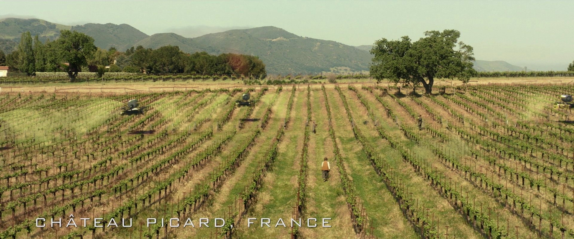
La Barre (or: Labarre) is Jean-Luc Picard's home village in France. La Barre is mentioned on a screen in TNG: "Conundrum" and spoken out by Picard in TNG: "Chain of Command II". The place can be seen in TNG: "Family" and in TNG: "All Good Things". Many years later, the château also appears in the first three episodes of Star Trek Picard, "Remembrance", "Maps and Legends" and "The End is the Beginning" and during the whole second season of the series. The region is represented by a matte painting in "Family". All episodes include footage that was filmed in different Californian vineyards, so the landscape doesn't look quite as it should in France. Still, the depiction of La Barre in Star Trek is overall relatively consistent.
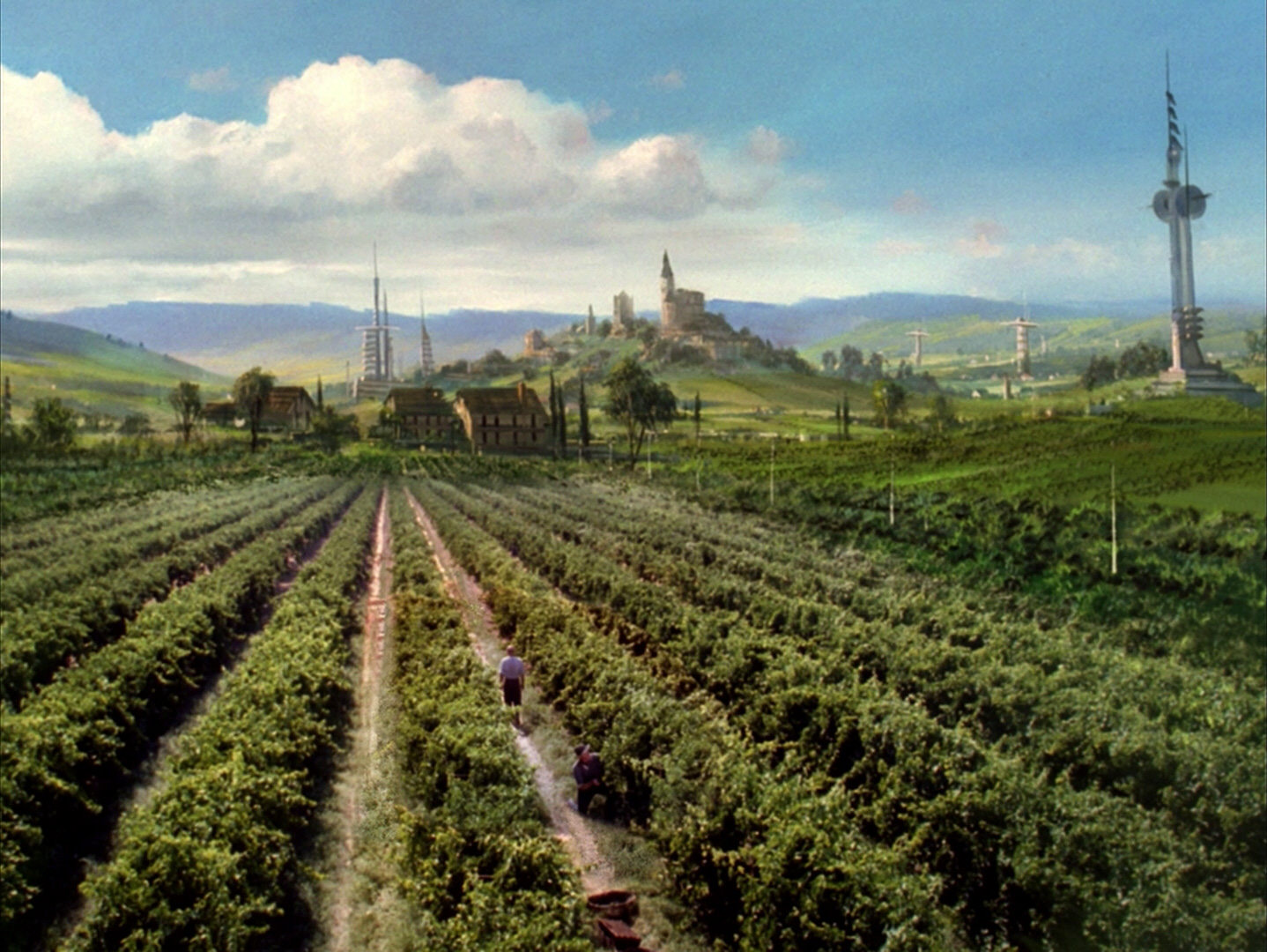

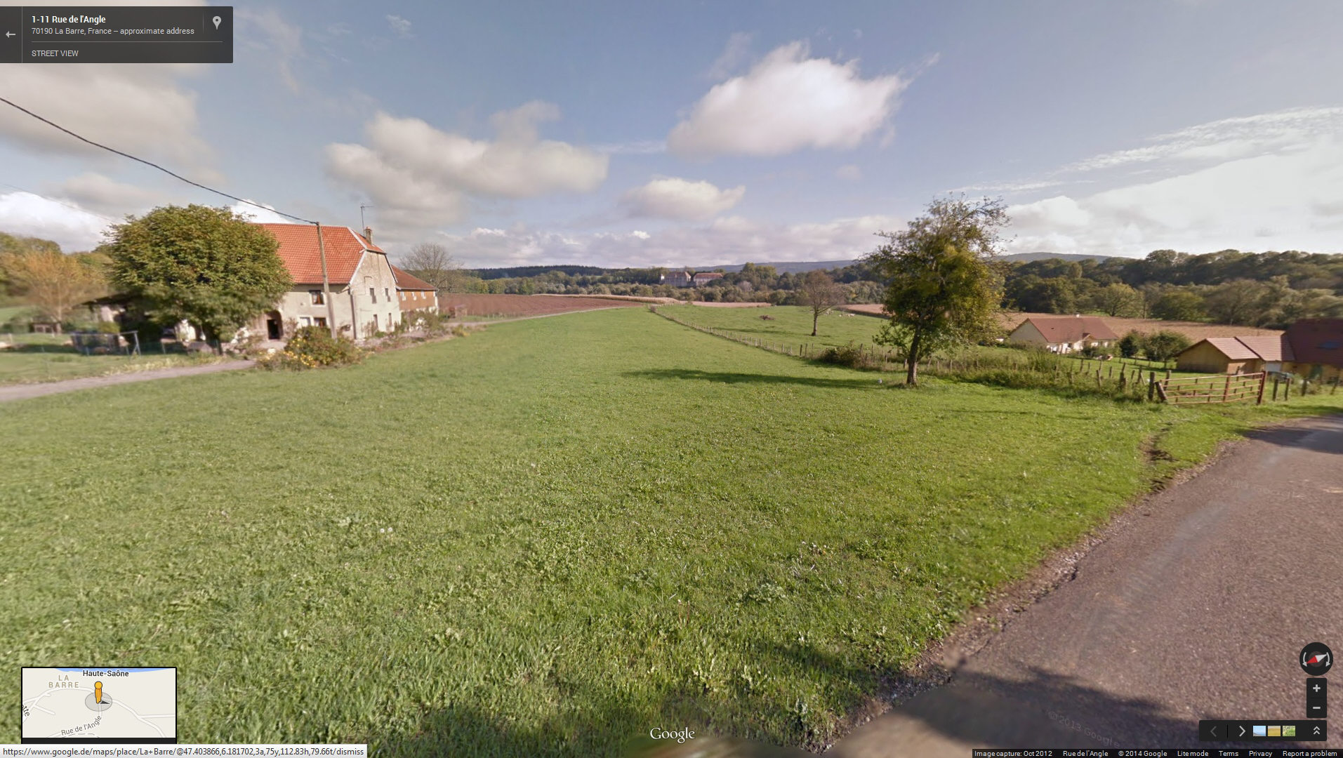
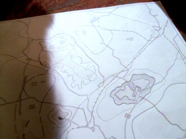
Most likely La Barre initially wasn't meant to be a specific French village, although the name may have come to pass by someone looking for actual place names on a map. There are several places named "Labarre" or "La Barre" (the bar) in France. The most likely candidate according to my research is La Barre, a small village in the department of Haute-Saône, region Franche-Comté (since 2016: region Bourgogne-Franche-Comté), in eastern France. Looking from the present-day village is eastern direction, we can see a small château in the center and some hills, similar as on the matte painting. The river Ognon flows right in front of the château. The château is not quite as impressive in our time, the hills are lower and there are meadows and corn fields in the place of the 24th century vineyards, but overall it seems close enough. (Well, we would have to ignore that in the 24th century the sun would be in the northern sky).
 Map of La Barre, Haute-Saône
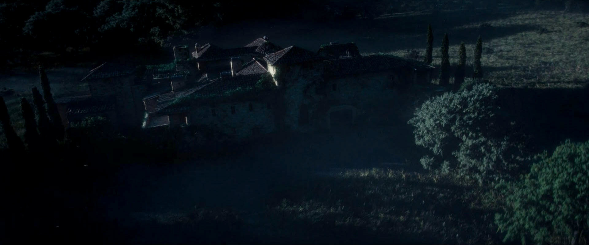
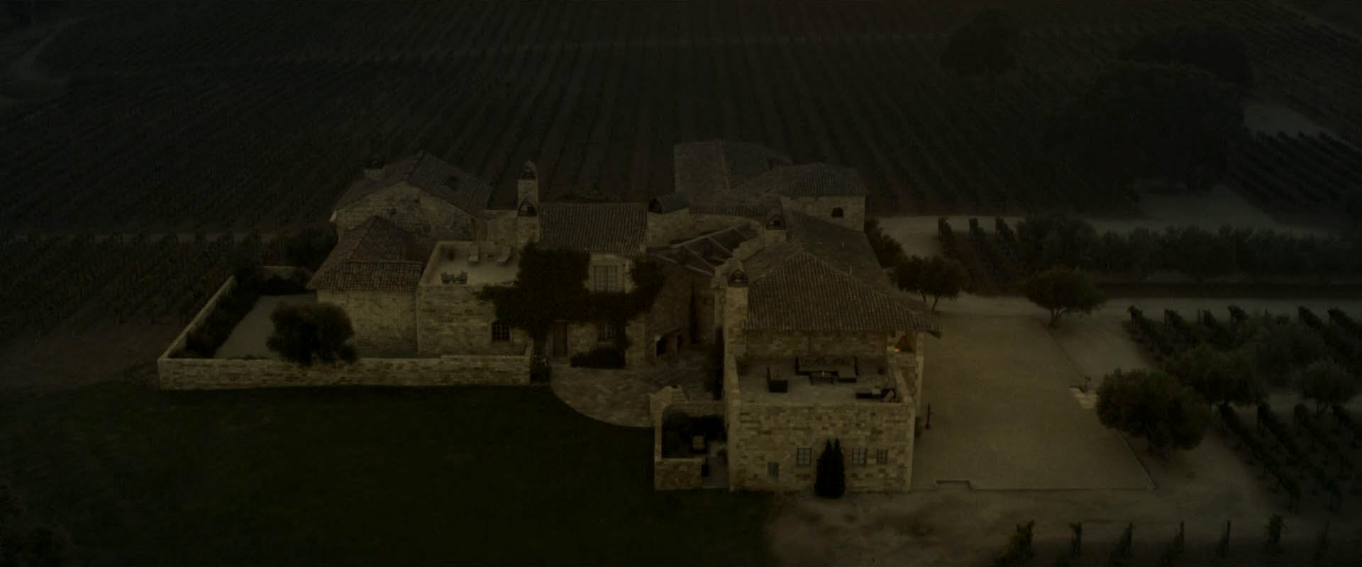
We can see two versions of the Picard family home in Star Trek. In TNG: "Family", it is a timber-frame house (filmed in Encino, California). Since PIC: "Remembrance", Jean-Luc Picard resides in the Château Picard, a very different looking stone building (filmed in The Sunstone Vineyards & Winery). In the first season of PIC, we could still attribute this to the fire that killed René and Robert Picard and may have destroyed the old house. Since PIC: "Assimilation", we know for sure that the château has existed in much he same form at least since the 20th century. It looks larger in the 2024 aerial view in "Watcher" than it would be in 2401 in "Farewell", though. We may argue that if wings were added and removed on the rear side, this may well include the timber-frame house from "Family".
After a bottle labeled as "Château Labarre" had been used on TNG, a new prop with the corrected designation "Château Picard" was created for "Star Trek Nemesis". The French inscription on that label contains a few errors, and unfortunately it does not provide further information on the location of La Barre.
A new bottle label for Château Picard red wine created for Star Trek Picard indicates that La Barre is indeed located in the region of Franche-Comté and retroactively confirms my suggestion that Picard's home village really exists and of where in France it can be found. The label reads "Château Picard - Bourgogne Franche-Comté". This is an interesting ambiguity because it could refer to the grape Bourgogne (Burgundy) produced in the region of Franche-Comté, or it could refer to the amalgamated region of Bourgogne-Franche-Comté (since 2016).


The area of La Barre, Haute-Saône, currently isn't known for its wine. The famous wine region Côte d'Or is located about 50km to the west. In PIC: "Watcher" in 2024, no wine is growing at the château because it has been abandoned, but we can recognize regularly arranged plants that look like remnants of vine stocks.
So while La Barre does exist in real life, there are some liberties in its depiction as a generic French village (with Californian architecture).
See Also
Re-Uses of the New York Streets Set - in-depth investigation of the set that appeared in 14 episodes
Re-Uses of the Little Europe Set - in-depth investigation of the appearances as Sainte Claire and as Fair Haven
Observations in PIC: "Remembrance"
Credits
Some screen caps from TrekCore and Memory Alpha. Thanks to Jim Hart for the theory and the evidence that Carbon Creek may be located in eastern Pennsylvania and to Bill G. for bringing Doylestown, OH to my attention.


